- Categories :
- More
Winter Storm and Hard Freeze Risk Grows

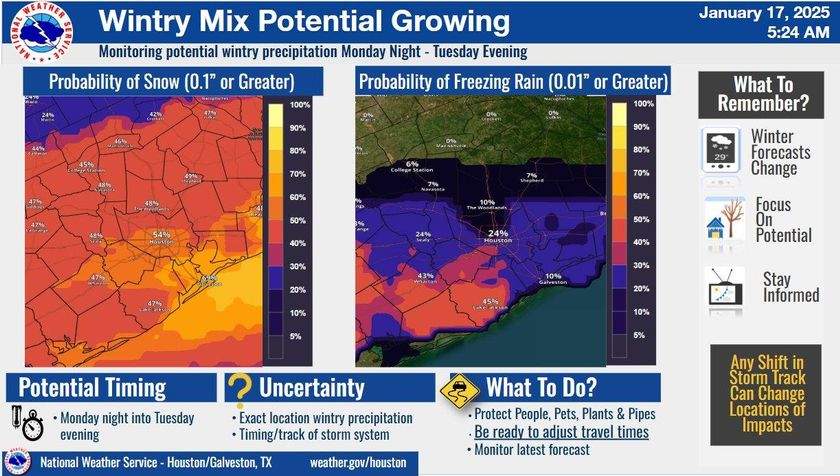
The U.S. National Weather Service (NWS) in Houston-Galveston is closely monitoring a developing winter storm and the potential for a hard freeze, with significant impacts expected early next week.
Current forecasts indicate an increasing likelihood of frozen precipitation in the region during the Monday night to Tuesday timeframe. Additionally, the risk of a hard freeze is expanding further south, particularly for Tuesday night into Wednesday morning.
“This forecast is subject to change as we gather more high-resolution short-term model guidance over the next 48 hours,” stated NWS Houston-Galveston. “We encourage residents to stay informed and begin preparations now.”
Key Points:
- Frozen Precipitation: Increasing chances Monday night through Tuesday.
- Hard Freeze: Expanding southward, with the most significant risk Tuesday night into Wednesday morning.
- Forecast Uncertainty: The storm remains outside the range of higher-resolution models, which means details may shift as new data becomes available later today and tomorrow.
The NWS emphasizes that this weekend presents an ideal opportunity for residents to take precautionary measures, such as insulating pipes, covering plants, and ensuring pets have adequate shelter. It’s also important to monitor updates as the forecast evolves.
For the latest information, visit the U.S. National Weather Service Houston-Galveston website or follow them on social media.


