- Sections :
- Crime & Public Safety
- Restaurants & Food
- Sports
- More
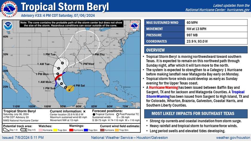
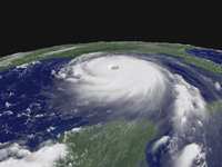
MONTGOMERY COUNTY, TX -- July 6, 2024 at 9:59:04 PM CDT
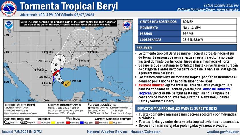
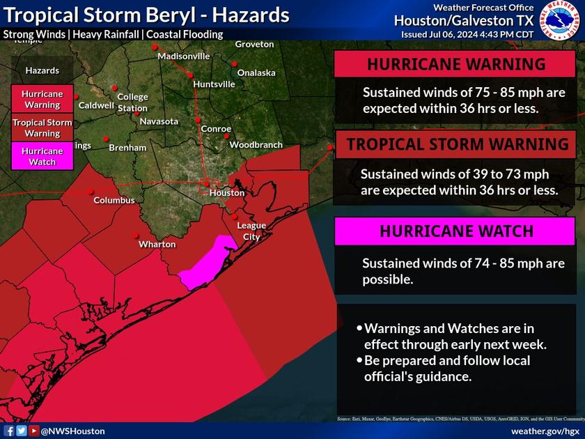
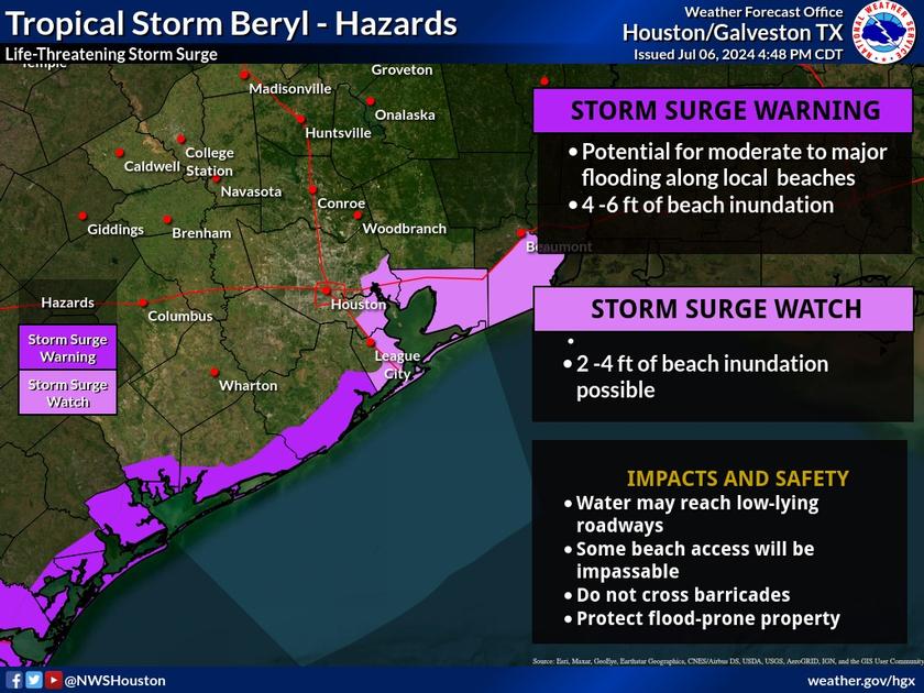
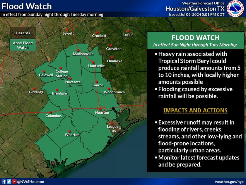
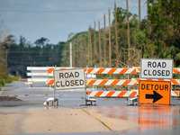
* WHAT...Flooding caused by excessive rainfall continues to be possible. * WHERE...Portions of south central and southeast Texas, including the following areas, in south central Texas, Coastal Jackson and Inland Jackson. In southeast Texas, Austin, Brazoria Islands, Brazos, Burleson, Coastal Brazoria, Coastal Galveston, Coastal Harris, Coastal Matagorda, Colorado, Fort Bend, Galveston Island, Grimes, Inland Brazoria, Inland Galveston, Inland Harris, Inland Matagorda, Madison, Matagorda Islands, Montgomery, Walker, Waller, Washington and Wharton. * WHEN...From late Sunday night through Tuesday morning. * IMPACTS...Excessive runoff may result in flooding of rivers, creeks, streams, and other low-lying and flood-prone locations. Creeks and streams may rise out of their banks. Flooding may occur in poor drainage and urban areas. * ADDITIONAL DETAILS... - Heavy rain associated with Tropical Storm Beryl is expected to pose a flash flooding threat for portions of SE TX. 5-10 inches of rainfall, with some locally higher amounts possible, are expected across portions of the area. This may result in street flooding, as well as rises along area rivers, creeks, streams, and bayous. - http://www.weather.gov/safety/flood
Flood Watch issued July 6 at 6:12PM CDT until July 9 at 7:00AM CDT by NWS Houston/Galveston TX
* WHAT...Flooding caused by excessive rainfall continues to be possible. * WHERE...Portions of south central and southeast Texas, including the following areas, in south central Texas, Coastal Jackson and Inland Jackson. In southeast Texas, Austin, Brazoria Islands, Brazos, Burleson, Coastal Brazoria, Coastal Harris, Coastal Matagorda, Colorado, Fort Bend, Grimes, Inland Brazoria, Inland Harris, Inland Matagorda, Madison, Matagorda Islands, Montgomery, Walker, Waller, Washington and Wharton. * WHEN...From late Sunday night through Tuesday morning. * IMPACTS...Excessive runoff may result in flooding of rivers, creeks, streams, and other low-lying and flood-prone locations. Creeks and streams may rise out of their banks. Flooding may occur in poor drainage and urban areas. * ADDITIONAL DETAILS... - Heavy rain associated with Tropical Storm Beryl is expected to pose a flash flooding threat for portions of SE TX. 5-10 inches of rainfall, with some locally higher amounts possible, are expected across portions of the area. This may result in street flooding, as well as rises along area rivers, creeks, streams, and bayous. - http://www.weather.gov/safety/flood