- Sections :
- Crime & Public Safety
- Restaurants & Food
- Sports
- More
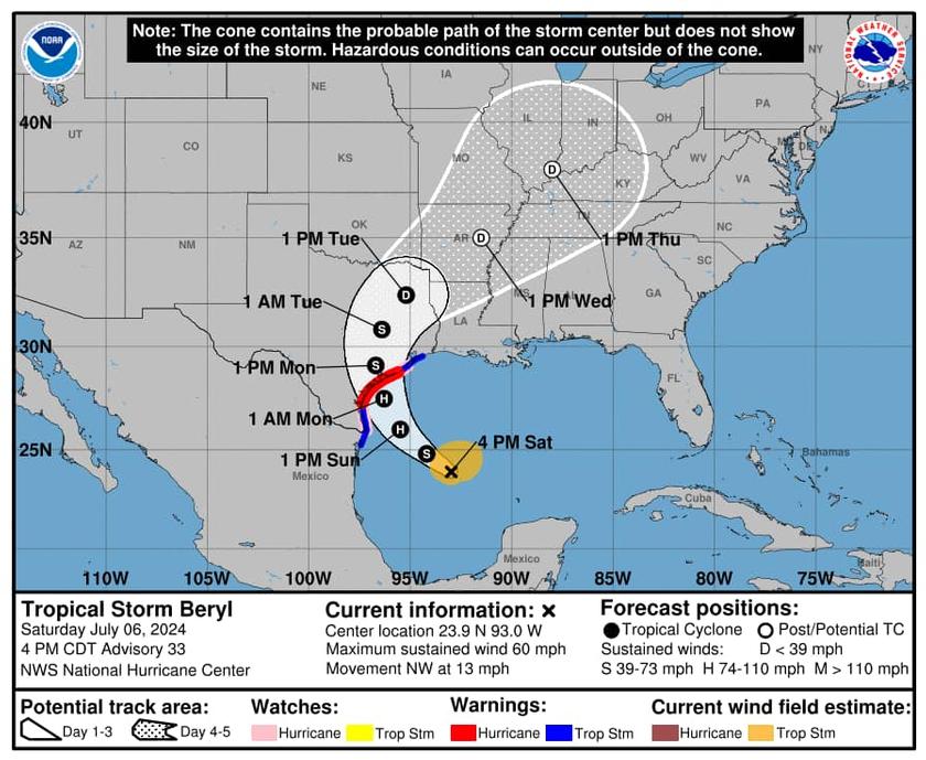
MONTGOMERY COUNTY, TX -- July 6th 7:00pm Update: Tropical Storm Beryl is expected to strengthen overnight and tomorrow making landfall early Monday morning around Matagorda Bay.
The center of circulation will be off to our north west as the storm makes its way into deep east Texas. This will put us on the “nasty” side of the storm. What does that mean?
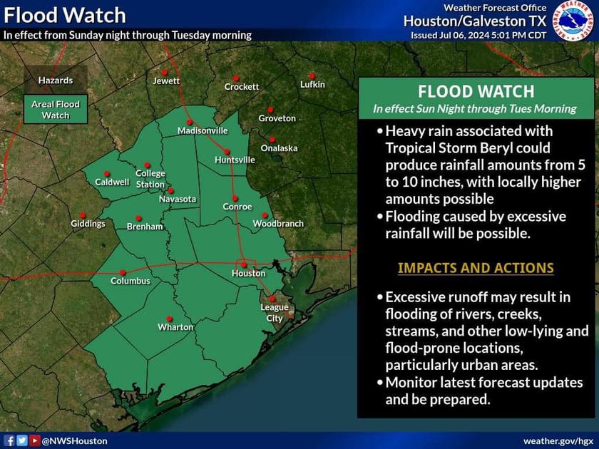
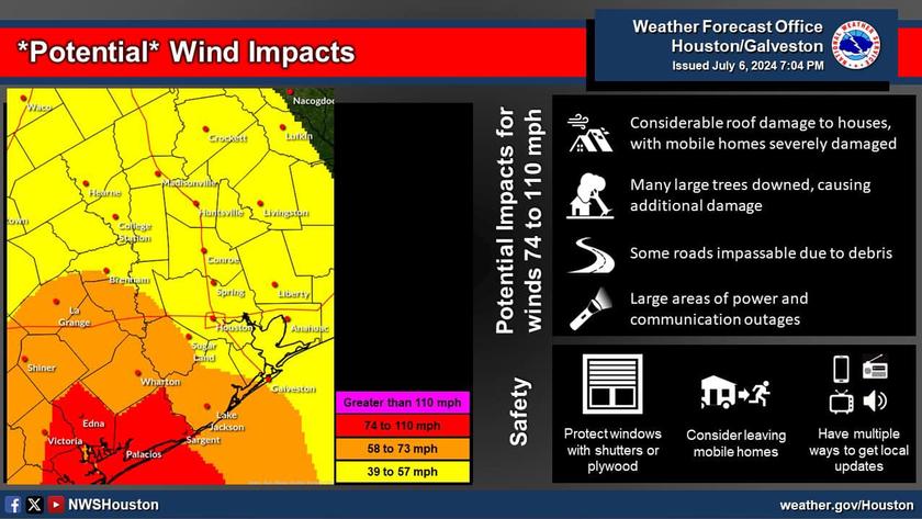
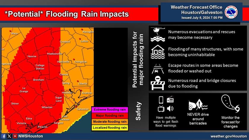
We can expect 5-10 inches of rain starting late Sunday through Tuesday. Some isolated areas with higher amounts. The higher amounts will be west of I-45. Tropical Storm winds will start arriving late Sunday and into Monday as well. Nothing major expected with the winds but we could see some gust above 40MPH. Sustained winds speeds should be manageable.
Power outages are possible with the wind threat. Be prepared for outages in case they happen. A flood watch is in effect for the County through Tuesday.
Please don’t drive in high water and Monday is a good day to avoid the roads unless you have no choice but to be out.
There remains a slight chance the track will shift further north east which puts us closer to the center of circulation and will increase our wind threat if that happens. Forecasters cannot rule out isolated tornadoes on Tuesday.
Please make final preparations tomorrow and heed warnings from our local officials and the weather service.
We expect another briefing from the National Weather Service in the morning around 11am and we will provide several updates through the day Sunday.
Acting Governor, Lt. Governor Dan Patrick has issued a disaster declaration for Texas which includes Montgomery County. This will free up state assets and resources should the need arise. Our office remains in constant contact with state and regional officials and we have been coordinating for several days now.