- Sections :
- Crime & Public Safety
- Restaurants & Food
- Sports
- More
MONTGOMERY COUNTY, TX -- 6:15 PM CDT Update: Tropical Storm Beryl remains on track to produce strong winds, heavy rain, storm surge, and flooding across SE TX. Here are the latest updates on what to expect for each of these potential hazards.
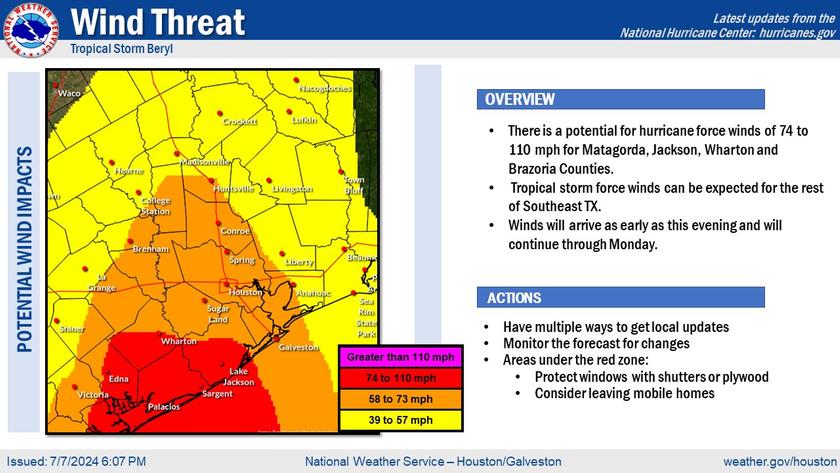
Wind Threat:
Overview
There is a potential for hurricane force winds of 74 to 110 mph for Matagorda, Jackson, Wharton and Brazoria Counties.
Tropical storm force winds can be expected for the rest of Southeast TX.
Winds will arrive as early as this evening and will continue through Monday.
Actions:
Have multiple ways to get local updates
Monitor the forecast for changes
Areas under the red zone:
- Protect window with shutters or plywood
- Consider leaving mobile homes
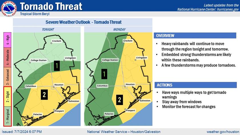
Tornado Threat:
Overview:
Heavy rainbands will continue to move through the region tonight and tomorrow.
Embedded strong thunderstorms are likely within these rainbands.
A few thunderstorms may produce tornadoes.
Actions:
Have ways multiple wayst to get tornado warnings
Stay away from windows
Monitor the forecast for changes
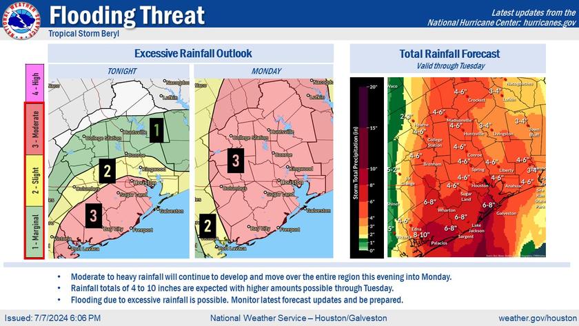
Flooding Threat:
Moderate to heavy rainfall will continue to develop and move over the entire region this evening into Monday.
Rainfall totals of 4 to 10 inches are expected with higher amounts possible through Tuesday.
Flooding due to excessive rainfall is possible. Monitor latest forecast updates and be prepared.